


Voting District 0993042000003, Macomb County, Michigan
About
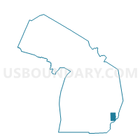
Outline

Summary
| Unique Area Identifier | 597904 |
| Name | Voting District 0993042000003 |
| County | Macomb County |
| State | Michigan |
| Area (square miles) | 0.42 |
| Land Area (square miles) | 0.42 |
| Water Area (square miles) | 0.00 |
| % of Land Area | 100.00 |
| % of Water Area | 0.00 |
| Latitude of the Internal Point | 42.52831050 |
| Longtitude of the Internal Point | -82.93603720 |
Maps


Graphs
Select a template below for downloading or customizing gragh for Voting District 0993042000003, Macomb County, Michigan


Neighbors
Neighoring Voting District (by Name) Neighboring Voting District on the Map
- Voting District 0993042000002, Macomb County, MI
- Voting District 0993042000004, Macomb County, MI
- Voting District 0993042000005, Macomb County, MI
- Voting District 0996980000015, Macomb County, MI
- Voting District 0996980000016, Macomb County, MI
- Voting District 0996980000018, Macomb County, MI
- Voting District 0996980000014, Macomb County, MI
Top 10 Neighboring County Subdivision (by Population) Neighboring County Subdivision on the Map
Top 10 Neighboring Place (by Population) Neighboring Place on the Map
Top 10 Neighboring Unified School District (by Population) Neighboring Unified School District on the Map
Top 10 Neighboring State Legislative District Lower Chamber (by Population) Neighboring State Legislative District Lower Chamber on the Map
Top 10 Neighboring State Legislative District Upper Chamber (by Population) Neighboring State Legislative District Upper Chamber on the Map
Top 10 Neighboring 111th Congressional District (by Population) Neighboring 111th Congressional District on the Map
Top 10 Neighboring Census Tract (by Population) Neighboring Census Tract on the Map
- Census Tract 2542, Macomb County, MI (4,413)
- Census Tract 2550, Macomb County, MI (4,374)
- Census Tract 2545, Macomb County, MI (4,248)
- Census Tract 2552, Macomb County, MI (3,770)
- Census Tract 2554, Macomb County, MI (2,697)